Data
Data is the engine of our solutions, for this reason, we have a wide variety of internal and external data streams to be able to achieve the conclusions that allow your business to leap to the next level within its competitive environment.
OUR datasets
Geospatial data is the engine of our solutions, those that will make you know in detail, and as you have never done before the reality of your business and the environment in which it is developed. For this reason, at Locatium we have a set of datasets specialized in various topics and scenarios. Here are the most relevant ones.
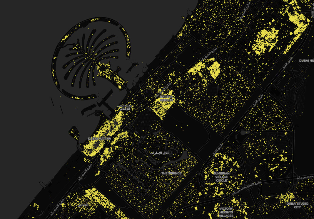

Human mobility
This includes data on the profiles and behaviors of people whose main purpose is to better know their characteristics and habits.
In this sense, we find sociodemographic aspects of the inhabitants of certain areas, locations of work areas, mobility of pedestrian flows, trends in visits to different environments (indoor and outdoor), customer acquisition areas for marketing actions, and in-depth knowledge of them.

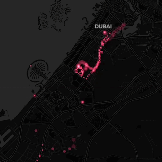
Vehicle Mobility
Information that is extremely useful when conducting advanced studies on road traffic flows in various scenarios and for various purposes.
Here we find data such as the vehicle count by road segment, parking fill levels and rotation rates of their parking spaces, speed patterns, transit times, driving isochrones, mobility patterns, trends in vehicle visits to certain areas, and many more.
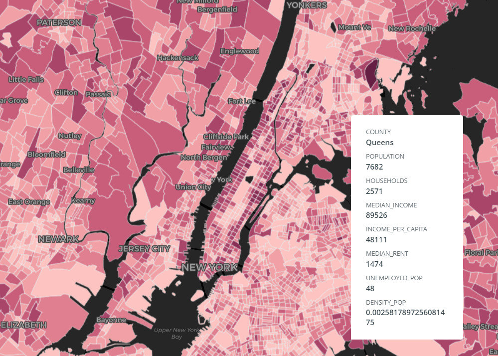
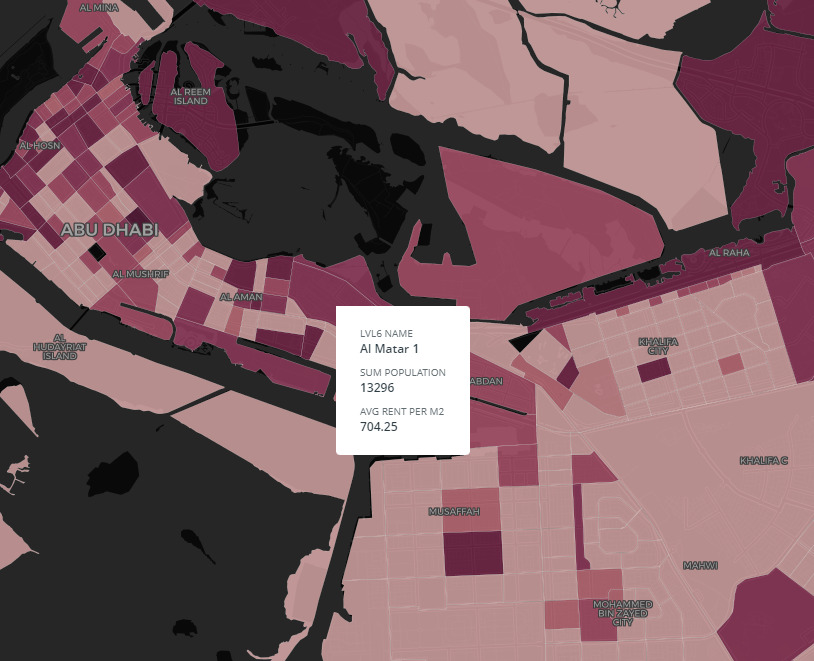
Population and Demographics
We refer to reliable and contrasted data to know in depth the demographic reality of the areas of interest to be analyzed and make decisions based on it.
Here we find aspects such as the number of inhabitants, the population density, the distribution by age or by gender or race, their educational levels, income, and other variables to study.
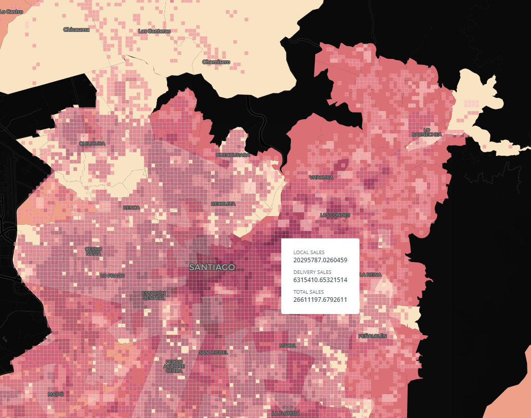
Consumption and Spend
Data to better understand the potential (or lack thereof) of various geographical areas to successfully offer them certain products and services.
Here, aspects such as the purchasing potential of its inhabitants, their disposable income, their average spending by product category, their consumption habits, among others, are collected.

Social Networks Insights
This data set provides information to study in more detail the characteristics of the population of certain locations based on their behavior on different social networks.
It is very useful to learn more about your preferences, behaviors, and opinions about different products or services, whether they are your own or those of your competitors.
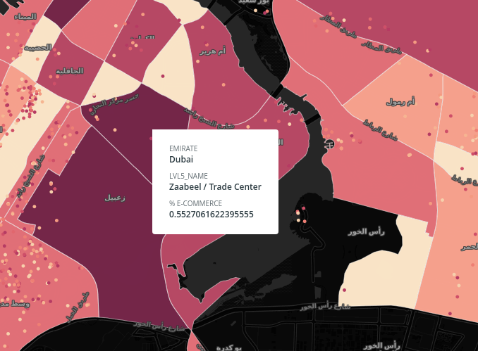
Real Estate Insights
The set of real estate data allows optimizing the management of operations typical of the Real Estate sector.
Here we can find price values by zones, which can be classified according to the property, whether it is for sale or for rent, if it is for residential or commercial use. Then this favors the analysis, either by square meter or by the number of rooms. In addition, these data facilitate the inventory of the properties in stock.
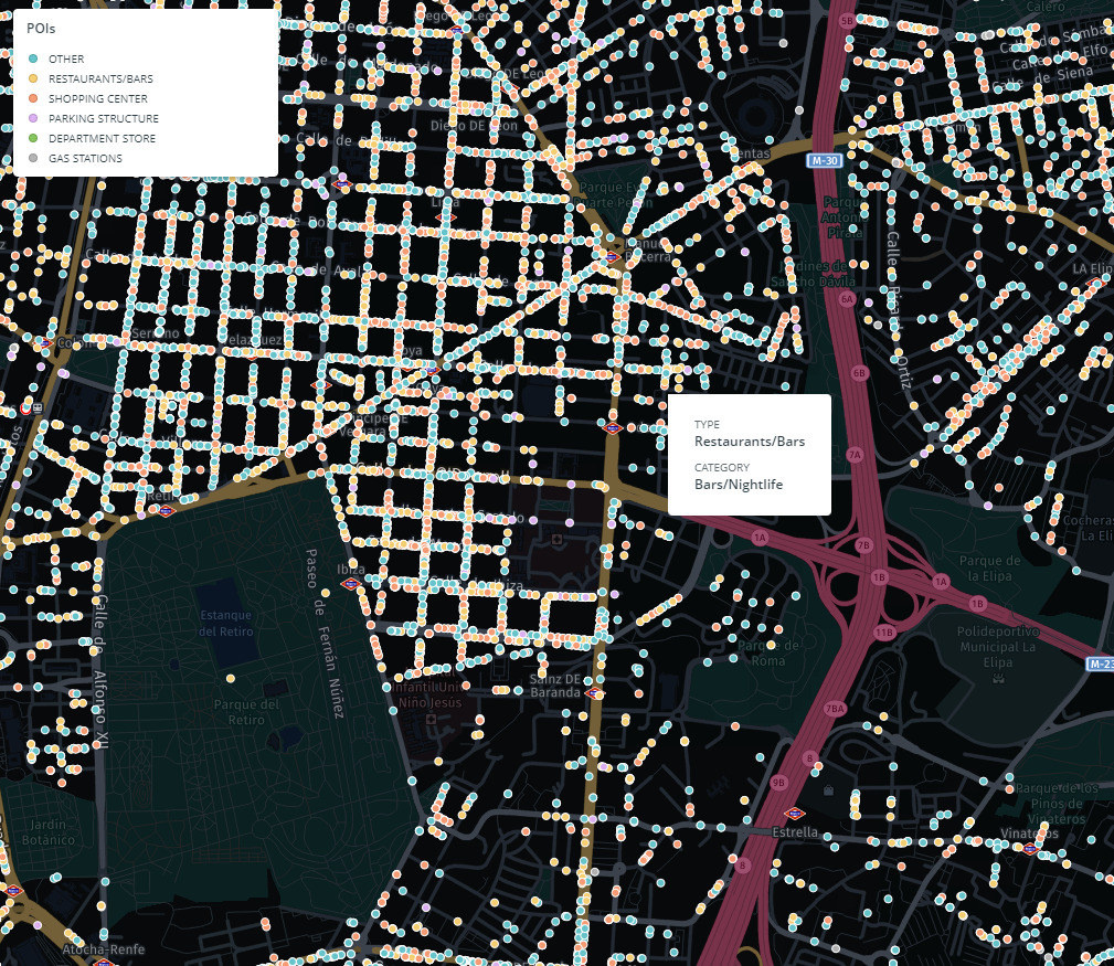
Points of Interest
Data strings containing POIs collect the location and characteristics of POIs. For example, the location of shops, parks, school zones, public transport stations, etc.
Not only do they stick to their location, but they also collect information about various qualities, images, and evaluations of their users.
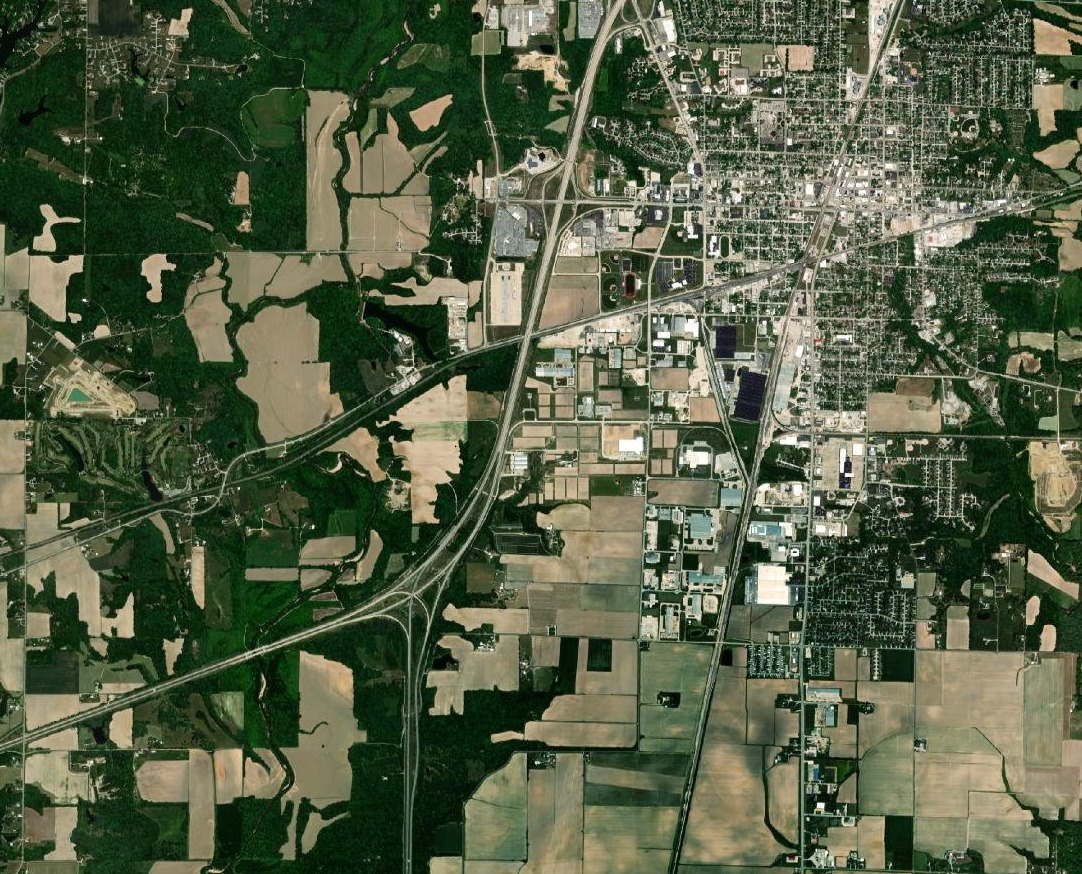
Satellite Imagery
Our data sets contain satellite photos of the areas to study for the knowledge and study in detail of their current reality.
These images can be taken with different resolutions and levels of detail, with visualizations during the day and at night, all according to the purpose of the project. With all this, advanced maps are prepared that collect the different points of interest.
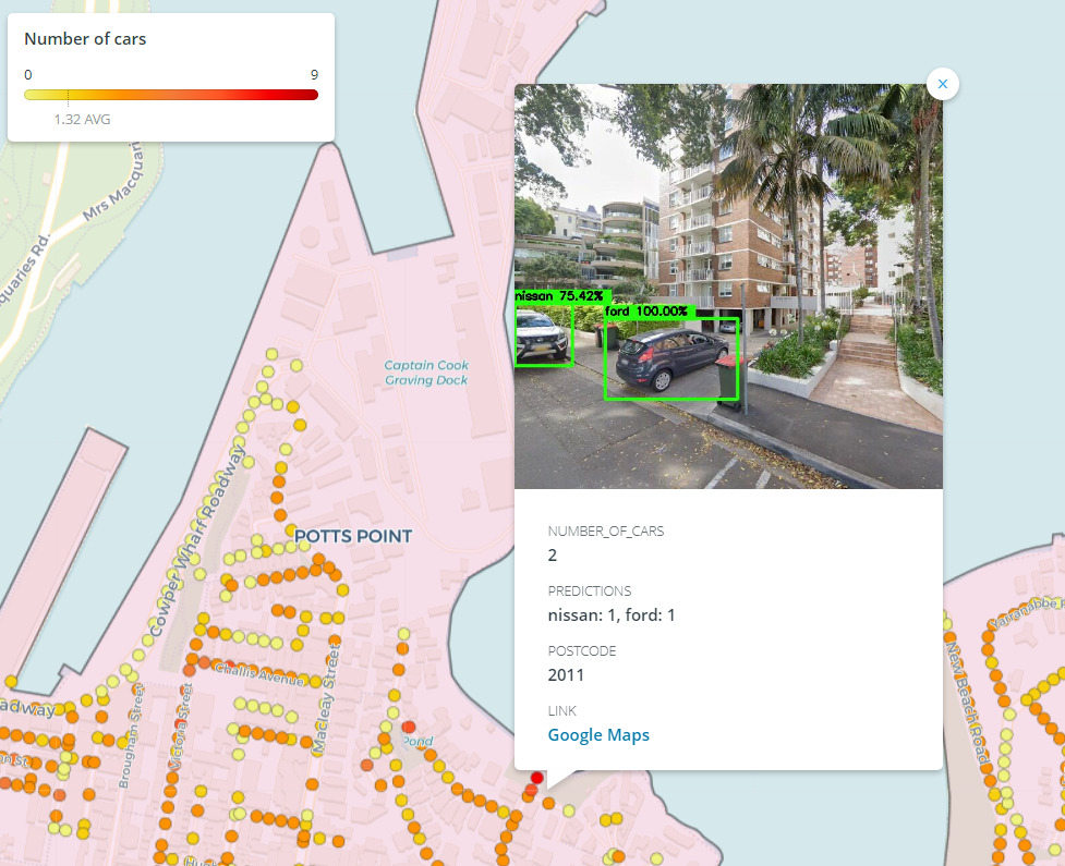
Street View Insights
Images at the street level reflect conclusions of value for a specific purpose.
Here we can talk about the numbers of vehicles parked on certain streets, their brands and years, inventories and state of maintenance of urban furniture, identification of architectural barriers, and many other types of information.
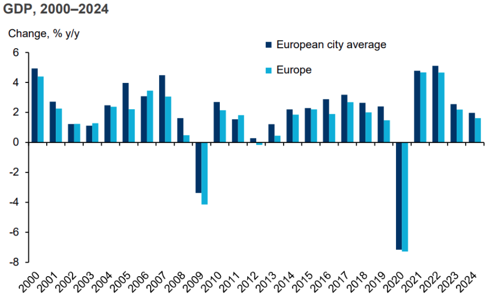
Macroeconomic Insights
In our algorithms/solutions, we include data from macroeconomic projections with projected indicators up to 25 years. Among these indicators are population, age distribution, family income data, etc. In addition, we also take into account GDP by sector (Telco, financial services, retail, agriculture, education …), employment by sector (Telco, financial services, retail, agriculture, education …), consumer spending by sector (Food and beverages, clothing and footwear, housing, water, electricity, gas, and other fuels) and country, region and
Credit Card Insights
Locatium Credit Card insights offers a detailed look at the geographic distribution of consumer financial transactions, what/when/where consumers are buying, along with a profile of the consumers.

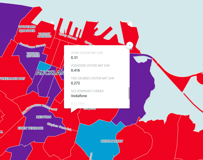
Telco Market share
Locatium Telco Insights allows you to understand telco market shares in micromarkets (even in a per-building basis). Understand what is the market shares of mobile and fixed networks by operators at a hyper granular level.
Tourism Insights
Locatium Tourism patterns such as an amount of tourist visitors, origin by country, places visited, spending patterns,… are key for Smart Cities and global Retailers.
Private Client Data API
Information from the company’s own internal operations and its tools and solutions, such as:
- CRM (Customer Relationship Management).
- ERP (Enterprise Resource Planning).
- Business Intelligence.
- Data Warehouse.
- Network KPIs.
- CRD / xDRs.
- Custom Integrations.
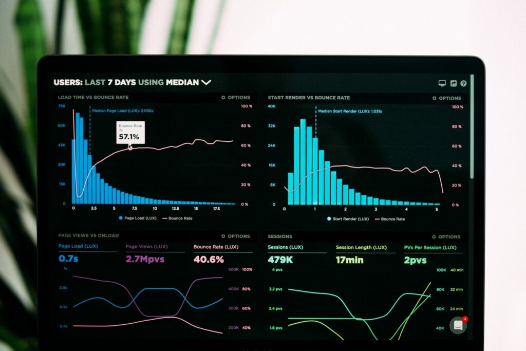
Our Platform
The result of processing all this data with technologies such as Machine Learning and Big Data is shown on a platform that contains interactive maps and graphics. Thus, you will be able to identify the trends and opportunities that will optimize your processes by making more accurate decisions.

Do you dare to get to know us better? We will be happy to arrange a meeting that will serve as a starting point for a successful journey towards your business goals.
What can this data be applied to?
Discover each area of action of our data streams by visiting our industries page.
Retail
Retail
FMCG
FMCG
Automotive
Automotive
Telco
telco
From Locatium we offer you a set of solutions that, applied to various sectors, will serve to optimize your processes. Get to know them more in-depth.